What Are The Richest States In The United States Of America?
In this article, we will talk about the top ten richest states in the United States, one after the other, starting from the first.
California (Population: 38 million)
California was admitted as the 31st state of the union on September 9, 1850, and by the early 1960s, it was the most populous U.S. state.
No version of the origin of California’s name has been fully accepted, but there is wide support for the contention that it derived from an early 16th-century Spanish novel, Las sergas de Esplandián (“The Adventures of Esplandián”), that described a paradisiacal island full of gold and precious stones called California.
The influence of the Spanish settlers of the 18th and 19th centuries is evident in California’s architecture and place names.
The capital is Sacramento.
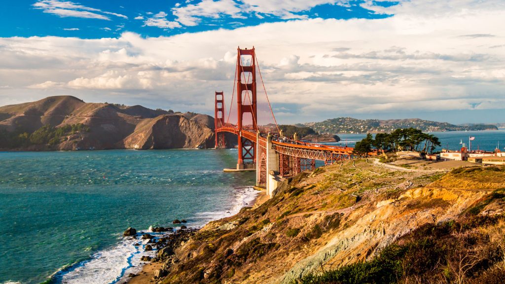
California: Image Source
California is bounded by the U.S. state of Oregon to the north, by the states of Nevada and Arizona to the east, by the Mexican state of Baja California to the south, and by the Pacific Ocean to the west.
From the rainy northern coast to the parched Colorado Desert in the south, and from the Mediterranean-like central and southern littoral to the volcanic plateau of the far northeast, California is a land of stunning physical contrasts.
Both the highest and lowest points in the 48 conterminous states are in the state of California—Mount Whitney and Death Valley, respectively.
The former is the culminating summit of the Sierra Nevada, one of the major mountain ranges of North America.
The fluid nature of the state’s social, economic, and political life—shaped so largely by the influx of people from other states and countries—has for centuries made California a laboratory for testing new modes of living.
California’s population, concentrated mostly along the coast, is the most urban in the United States, with more than three-fourths of the state’s people living in the Los Angeles, San Francisco, and San Diego metropolitan areas.
Despite its urbanization and the loss of land to industry, California still leads the country in agricultural production.
About one-half of the state’s land is federally owned. National parks located throughout the state are devoted to the preservation of nature and natural resources.
Illinois (Population: 13 million)
Illinois stretches southward 385 miles (620 km) from the Wisconsin border in the north to Cairo in the south.
In addition to Wisconsin, the state borders Lake Michigan to the northeast, Indiana to the east, Kentucky to the southeast, Missouri to the west, and Iowa to the northwest.
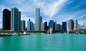
Illinois: Image Source
Illinois was named after the Illinois Indians.
The capital is Springfield, in the west-central part of the state.
Rich in coal and petroleum reserves and ideally located for the acquisition of raw materials and distribution of finished goods, Illinois ranks among the top states in value of exports, agricultural income, and value-added by manufacturing.
Politically, Illinois has tended to be a “swing state,” its votes often mirroring fluctuating social tensions that underlie the growing, but unevenly distributed, economic prosperity.
New Jersey (Population: 9.3 million)
One of the original 13 states, New Jersey is bounded by New York to the north and northeast, the Atlantic Ocean to the east and south, and Delaware and Pennsylvania to the west.
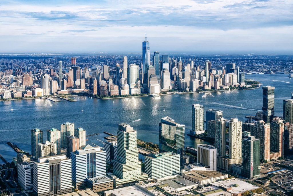
New Jersey: Image Source
The state was named for the island of Jersey in the English Channel.
The capital is Trenton.
Although it has major social, economic, and political force in its own right, New Jersey is sometimes looked upon as a stepchild among the heavily industrialized and populated states along the Eastern Seaboard.
New Jersey is one of the smallest states in area, but it is highly urbanized and has one of the country’s highest population densities.
Hundreds of thousands of its citizens commute to New York and Pennsylvania.
New Jersey’s transportation system is one of the busiest and most extensive in the world, and it weaves the state into the fabric of the region by funneling goods and people to New York City and other points north and to Philadelphia and points south.
For hundreds of thousands of visitors it offers long stretches of fine beaches along the Atlantic Ocean, and the resort town of Atlantic City may be better known than the state itself.
Above all, New Jersey is rife with contradiction and anomaly.
Its people fiercely fight off attempts of state government to end home rule by powerful municipal administrations.
While the state has produced some of the most able and respected U.S. governors, corruption has often played a part in its local politics, and it has achieved notoriety as a major locus of organized crime.
New Jersey is called the Garden State because it became famous in the 18th century for the fertility of its land.
It is now also among the most urbanized and crowded of states. The urban density of its northeast contrasts sharply, however, with the rugged hills of the northwest, the enormous stretches of pine forest in the southeast (the Pine Barrens), and the rolling and lush horse country in the south-central part of the state.
New Jersey is an important industrial center, but it has paid the price in environmental pollution, in dirt and noise, and in congested roads and slums.
In sum, New Jersey is a curious amalgam of urban and rural, poor and wealthy, progressive and conservative, parochial and cosmopolitan.
Indeed, it is one of the most diverse states in the union.
Massachusetts (Population: 6.9 million)
Massachusetts (officially called a commonwealth) is bounded to the north by Vermont and New Hampshire, to the east and southeast by the Atlantic Ocean, to the south by Rhode Island and Connecticut, and to the west by New York.
It is the seventh smallest of the U.S. states in terms of total area.
Its capital is Boston, the state’s most populous city.
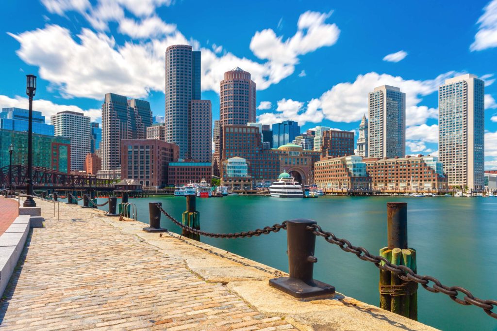
Massachusetts: Image Source
English explorer and colonist John Smith named the state for the Massachuset tribe, whose name meant “near the great hill”—believed to refer to Blue Hill, which rises south of Boston in an otherwise flat area.
Massachusetts’s residents represent an amalgamation of the prototypical Yankee spirit of an earlier America and the energies of the later immigrants who flocked to its cities in the 19th and 20th centuries.
Massachusetts is unique among states because its history and culture predate and epitomize the experiences of the country as a whole.
It is commonly known that the Puritans and Pilgrims set the stage for eventual liberty of religious belief when they fled an oppressive government to settle in the New World. With such documents as the Mayflower Compact (1620) and the Body of Liberties (1641), an early code of law, they provided the basis for the concept that governments should rule by consent of the governed and with guarantees to protect individual expression.
These notions of individual liberty came into conflict with the colonies’ status as part of the British Empire.
The American Revolution originated in Massachusetts with the first resistance against British colonial rules.
It was in Massachusetts that the colonists raised the hue and cry against taxation without representation, as exemplified by the Boston Tea Party; the activism of the Massachusetts colonists inspired others and culminated in the “shot heard round the world” at the Battles of Lexington and Concord in 1775.
Massachusetts was in the vanguard when the new country began transforming itself from an agrarian to an industrial economy.
The state’s merchants, such as Francis Cabot Lowell, whose fortunes depended on trade, sought safer investments after severe losses during the War of 1812.
Textile, boot, and machinery manufacturing began in Massachusetts (and Rhode Island) and set the groundwork for the eventual industrialization and urbanization of the northeastern states. Farmers and their sons and daughters trekked to the new cities; by the mid-1870s, Massachusetts had become the first state in the Union in which more people lived in towns and cities than in rural areas.
Washington (Population: 6.8 million)
Lying at the northwestern corner of the 48 conterminous states, Washington is bounded by the Canadian province of British Colombia to the north, the U.S. states of Idaho to the east and Oregon to the south, and the Pacific Ocean to the west.
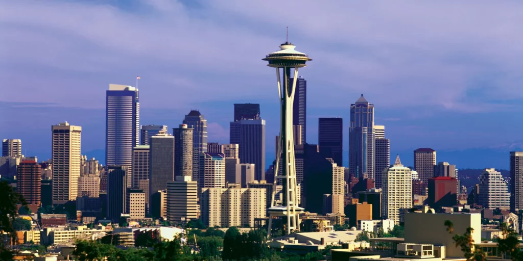
Washington: Image Source
The capital is Olympia, located at the southern end of Puget Sound in the western part of the state.
The state’s coastal location and excellent harbours give it a leading role in trade with Alaska, Canada, and countries of the Pacific Rim.
The terrain and climate of Washington divide the state into a rainy western third and a drier eastern two-thirds in the rain shadow of the Cascade Range.
Western Washington industries depend on agriculture, forests, and fisheries and imported raw materials, whereas eastern Washington is mainly agricultural, producing wheat, irrigated crops, and livestock.
Most of the people live in the highly urbanized area around Puget Sound that includes Seattle, Everest, Tacoma, and other cities.
Minnesota (Population: 5.3 million)
Minnesota became the 32nd state of the union on May 11, 1858.
A small extension of the northern boundary makes Minnesota the most northerly of the 48 conterminous U.S. states.
Minnesota is one of the north-central states.
It is bounded by the Canadian provinces of Manitoba and Ontario to the north, by Lake Superior and the state of Wisconsin to the east, and by the states of Iowa to the south and South Dakota and North Dakota to the west.
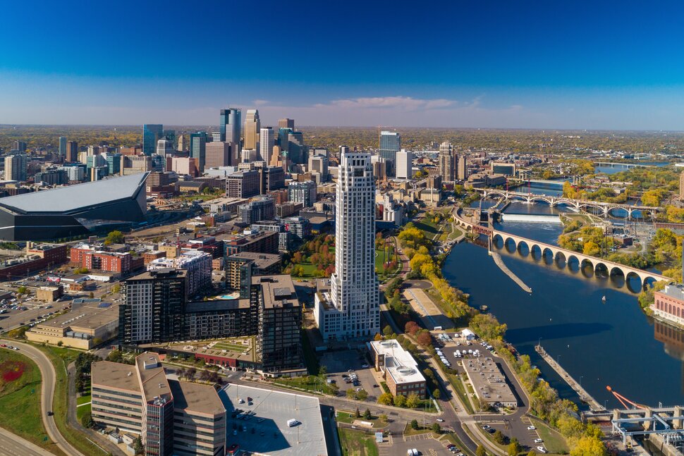
Minnesota: Image Source
Minnesota’s thousands of rivers flow northward via the Red and Rainy rivers to Hudson Bay, eastward through the Great Lakes to the Atlantic Ocean, and southward through the Mississippi River to the Gulf of Mexico.
Indeed, Minnesota received its name from the Dakota (Sioux) word for the Mississippi’s major tributary in the state, the Minnesota River, which means “sky-tinted water.”
Nebraska (Population: 1.8 million)
Nebraska was admitted to the union as the 37th state on March 1, 1867.
Nebraska is bounded by the state of South Dakota to the north, with the Missouri River making up about one-fourth of that boundary and the whole of Nebraska’s boundaries with the states of Iowa and Missouri to the east.
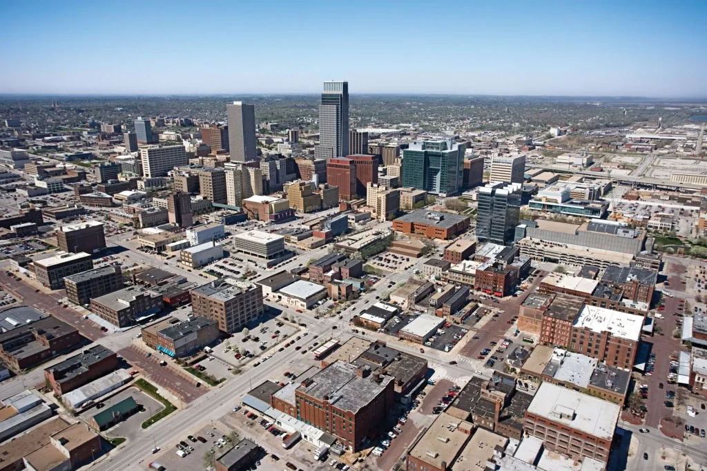
Nebraska: Image Source
The boundary with Kansas to the south was established when the two territories were created by the Kansas-Nebraska Act in 1854.
In the southwestern part of the state, the boundary with Colorado forms a right angle (south and west), which creates Nebraska’s panhandle, to the west of which is the boundary with Wyoming, Lincoln, in the southeastern part of the state, is the capital.
Rhode Island (Population: 1.1 million)
Rhode Island is bounded to the north and east by Massachusetts, to the south by Rhode Island Sound and Block Island Sound of the Atlantic Ocean, and to the west by Connecticut.
It is the smallest state in the union—only about 48 miles (77 km) long and 37 miles (60 km) wide—but is, however, one of the most densely populated states.
The extreme compactness of area, proportionally large population, and economic activity have tied it closely to its neighbouring states.
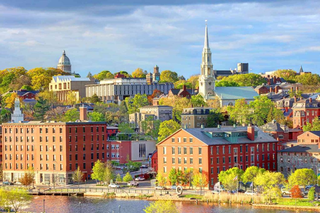
Rhode Island: Image Source
In addition, Rhode Island’s intimate connection to the sea—including more than 400 miles (640 km) of coastline—is the basis of its nickname, the Ocean State.
The capital is Providence.
Alaska (Population: 730,000)
Alaska lies at the extreme northwest of the North American continent, and the Alaska Peninsula is the largest peninsula in the Western Hemisphere.
Because the 180th meridian passes through the state’s Aleutian Islands, Alaska’s westernmost portion is in the Eastern Hemisphere.
Thus, technically, Alaska is in both hemispheres.
Alaska is bounded by the Beaufort Sea and the Arctic Ocean to the north, Canada’s Yukon territory and British Columbia province to the east, the Gulf of Alaska and the Pacific Ocean to the south, the Bering Strait and the Bering Sea to the west, and the Chukchi Sea to the northwest.
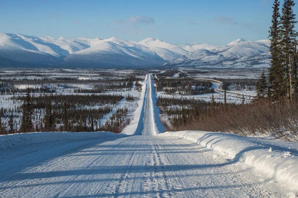
Alaska: Image Source
The capital is Juneau, which lies in the southeast, in the panhandle region.
Alaska is central to the great circle route connecting North America with Asia by sea and air and is equidistant from most of Asia and Europe.
That central location has made Alaska militarily significant since the Japanese invasion of the Aleutians in 1942 during World War II.
Alaska’s eastern border with Canada is about 1,538 miles (2,475 km) long, more than one-third the length of the entire U.S. boundary with Canada (3,987 miles [6,416 km]).
Alaska’s western maritime boundary, separating the waters of the United States and Russia, was established in the Treaty of Cession of 1867 (which declared the transfer of Alaska from Russia to the United States).
The roughly 1,000-mile (1,600-km) de facto boundary runs through the Chukchi Sea and the Bering Strait to a point between Alaska’s St. Lawrence Island and Russia’s Chukotskiy (Chukchi) Peninsula and to the southwest, between Attu Island, the westernmost island of the Alaskan Aleutian chain, and the Russian Komandor Islands.
The boundary leaves a patch of international waters, known as the “Doughnut Hole,” in the Bering Sea. Off the extreme western end of the state’s Seward Peninsula, Little Diomede Island, part of Alaska, lies in the Bering Strait only 2.5 miles (4 km) from Russian-owned Big Diomede Island.
Both Russia and the United States have shown a tacit tolerance of unintentional airspace violations, which are common in bad weather.
Wyoming (Population: 580,000)
Wyoming shares boundaries with six other Great Plains and Mountain states: Montana to the north and northwest, South Dakota and Nebraska to the east, Colorado to the south, Utah to the southwest, and Idaho to the west.
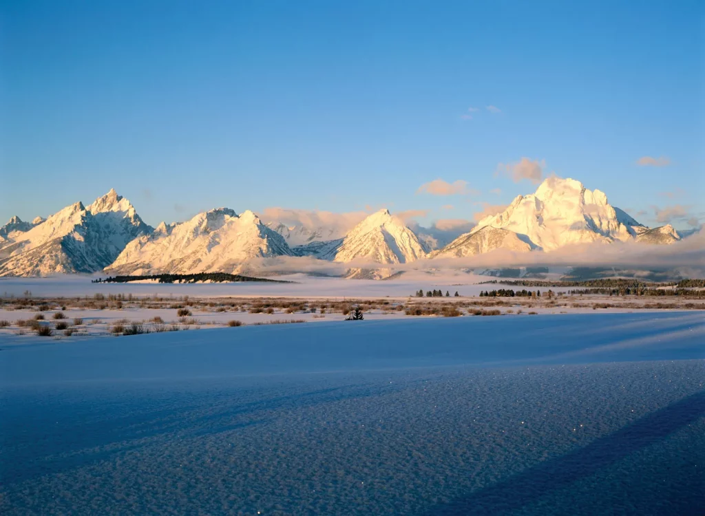
Wyoming: Image Source
Cheyenne, the capital, is located in the southeastern corner of the state.
The word Wyoming is derived from a Delaware word meaning “land of vast plains,” an apt description of the state’s spacious natural environment, which is home to nearly as many pronghorn as people.
Wyoming’s residents are spread across the land in small ranching and farming towns, in mining settlements, and in communities offering unparalleled outdoor recreational opportunities.
Each year millions of people visit Yellowstone and Grand Teton national parks. Moreover, the state has a low crime rate and little pollution.
One of Wyoming’s nicknames is the Equality State, because it was the first state in the country to approve a constitution that included a provision granting women the right to vote.
Conclusion
These states are considered to be wealthy due to their overall economic output, income, revenue and other economic elements and determiners.


